Play in wartime schoolscapes

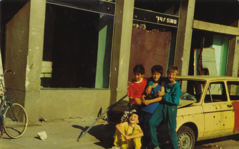
1992-1996, the city of Sarajevo is under siege and the children cannot attend school, play or move as freely as they would like.

But scattered initiatives started to provide children with a basic need: schooling. A person, often a professor, will gather the children hiding in the basement of the building and some others from the vicinity and will organize a class. These initiatives will quickly build up into a local school system put in place by the Pedagogical Institute of the city to pursue schooling during the war and under the extreme conditions of siege that the city of Sarajevo was painfully undergoing.

This will reveal to be a memorable experience for both teachers and students. Sarajevo is unique in that sense; not only for conducting class during wartime; which is something that already happened in other cities: Beirut, Kosovo, the Jewish ghetto in Warsaw; but for “building” a system of schooling that spread in all the zone of free Sarajevo. This, undoubtedly, changed the experience of schooling for children, and probably their perception of the world.

From an activity that conventionally takes place in a school building, schooling will become a “subversive” activity occurring in makeshift classrooms: a basement, an abandoned shop, etc. considered safe. These spaces were called punkts, and it is estimated that the city counted 360. These classrooms were also different; few had desks, without lighting, or even a board. Organized in a network system, occurring in a moment of suspension of all rules, defying the violence and restrictions of war, schooling will become a form of play, a détournement of a situation, an almost subversive activity.

For Maria Montessori, play is a fragment of space and time situated in between an individual and the world. It is in this space-time frame that the individual builds up his own self and also a representation of the world. That is why it such an essential activity, its absence endangers the children’s ability to confront the “outside”.

For the issue #44 of the Canadian Magazine, On site review, on the theme of “Play” my contribution with the article Play in wartime schoolscapes tackles this idea of schooling as a subversive act enacted like play by detouring all the features related to this activity. In Sarajevo’s war schoolscapes, overlapped the spaces “assigned” to this activity. All the urban elements became accomplice of the children’s walk to school, a risky itinerary at the core of this play.

At the end, this article builds upon the research related to the first children’a playgrounds designed as public amenities and their relation to post-war urban reconstruction. Ranging from the junk playgrounds first appearing under Nazi occupation in Denmark to the “in-between” playgrounds of Aldo Van Eyck in post-war Amsterdam, these playgrounds will finally lay the grounds for the recognition of children as urban actors in the urban space.

A short post-script draws attention to the actual situation in the Gaza strip, where children, again painfully strive and resist through play.

The issue of On site review is available online. For a reading of my article follow the links.

www.onsitereview.ca

or

https://issuu.com/onsitereview/docs/44play?fr=sN2E0MzcxNTI2NDI

Photo credits: Personal archive of Čedo Pavlović.

Mapping schooling under siege: an interview

For the past two years, while living in Sarajevo, I came across a book titled The heroes of Treća Gimnazija by the american pedagogue David M. Berman.

In his book, Berman narrates how schooling was carried on in the city of Sarajevo during the war and siege that took place between 1992 and 1996. Starting as scattered initiatives in basements, classes soon came to be part of a network put in place by the Pedagogical Institute and the school directors in town to keep up with the educational program. These makeshift spaces were called punkts, and considered a safer option to the school buildings, often destroyed or targeted. It is estimated that 300 punkts were disseminated in Sarajevo.

Berman’s story is very spatial; there are testimonies of the itinerary of the walks of some professors, also a detailed description based on schools almanacs of the network’s structuring in relation to the local communities. Local communities, or Mjesna Zajedniče MZ, are the smallest urban entity corresponding to a self-managed neighborhood. Indeed, the schooling punkts were distributed according to this already present pattern of MZ in the urban matrix: each school was responsible for a number of MZ and of the schooling punkt located in each MZ. In that way, all the students living in an MZ had to attend this point, thus avoiding dangerous displacements in the city, while teachers, instead, had to walk from their house to attend the different punkts.

30 years later, I traced the itinerary of the director and of one of the professors of the Treća Gimnazija high school during the war. I also indicate all the schooling punkts that I could geo-locate on the map of Sarajevo under siege.

While walking along this itinerary, the cityscape unfolds. It was an opportunity and a coincidence that the trajectory of one of the professors almost crossed the town, from the newest Yugoslav socialist part until the 19th century Austro-Hungarian part of town, These spaces of everyday life, the large scale residential neighborhoods and buildings, are highlighted on the map and reclaim their right to archive in contrast to iconic architecture.

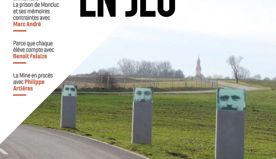
This endeavour, even if on a smaller scale, is part of the Sentiers Métropolitains network, where walking itineraries are projected in different cities in Europe but also in other cities like Boston or Tunis. In the spring of 2023, an interview realized by the geographer Jordi Ballesta regarding the project was published in the magazine Mémoires en Jeu for the issue n°18 under the theme Mémoires hors les murs.

Beirut, thoughts on Lyon’s 16th Art Biennial

The ongoing 16E Bienniale d’Art Contemporain of Lyon stages the life of Louise Brunet as the major inspiration for the Biennale’s theme: Manifesto of Fragility (https://www.labiennaledelyon.com/manifesto-of-fragility-menu). The aim is to shed light on the micro-stories often pulled aside in the making of the historical meta-narration; and Louise, a silk spinner from Lyon that ended up in Mount Lebanon, becomes the symbol of all these stories untold through time. Variegated art pieces and installations try to grasp this sense of fragility in fleeting narratives enclosed in objects, archive, relics, sculptures, reframing a history of the intimate in an anachronic fashion escaping from Historical time.

Beirut is very present in the biennial through many artistic representations, and it is no wonder, because it has been the product, the spatial construction of this historical meta-discourse. A city on the periphery, its birth as a capital is a micro-story in relation to the History unfolding in the mid XIXth century and the construction of a world system. The superposition of Lyon and Beirut, inevitably brought to my mind the work I did on urban Beirut between 1830-1920 in 2014* that studied Beirut as an extended territory of production in relation to the metropolis, Lyon, and all the consequences it had on her urban growth within a dying Ottoman empire, culminating in the creation of Lebanon.

The city came to being as the capital of Grand Lebanon on the 1st of September 1920 in a declaration by French general Gouraud. Before, its situation was best described in this conversation at the Quai d’Orsay in October 1919:

Philippe Berthelot: Mais Beyrouth fait partie du Liban.

Emir Faisal: Beyrouth n’est pas compris dans les frontières du Liban actuel.1

Too many interests were at stake to keep Beirut as a free port. Mount Lebanon was the main provider of silk to the factories in Lyon after the pébrine disease in the mid XIXth century disseminated the silkworms in a plague that extended in France and Italy. The Ottoman’s had already spread the telegraph network for financial transactions and investments in local infrastructure as soon as 1874, Comte De Perthuis had achieved the founding of the Beirut port company in Paris in 1886, and when Gouraud arrived to Lebanon, he had to create a territoriality that would suit needs of the metropolis (France) and its local partners.

The construction of Lebanon has been commented as follows by George Fayyad in a letter to Alfred Sursock “it is a monster as it head [Beirut] is bigger than its body” 2. I can´t help but think of the figure of the minotaur, trapped in the labyrinth, but this time a silk thread won´t do, the sacrifices to keep it alive, since its birth until now, didn´t stop.

The creation of Lebanon, consisting of territorial annexations, such as Beirut, Sidon, Tripoli and the Bekaa valley to Mount Lebanon is a micro-story within the big lines of history shaping the world at the beginning of the XXth century; but that is vital to understand the spatialities we are living in, be it at the usines Fagor of Lyon or in a city like Beirut. Micro narratives occur at different scales.

* CHOUEIRI, Darine (2014) “Beirut 1830-1920, A scalar fix on shifting grounds”, Territorios en formación (8), pp: 61-82.
1 MANSEL, Philip (2010) Levant, Splendour and Catastrophe on the Mediterranean, Yale university press, pp: 296.
2 MANSEL, Philip (2010) Levant, Splendour and Catastrophe on the Mediterranean, Yale university press, pp: 299.

Les Sentiers Métropolitains in Sarajevo

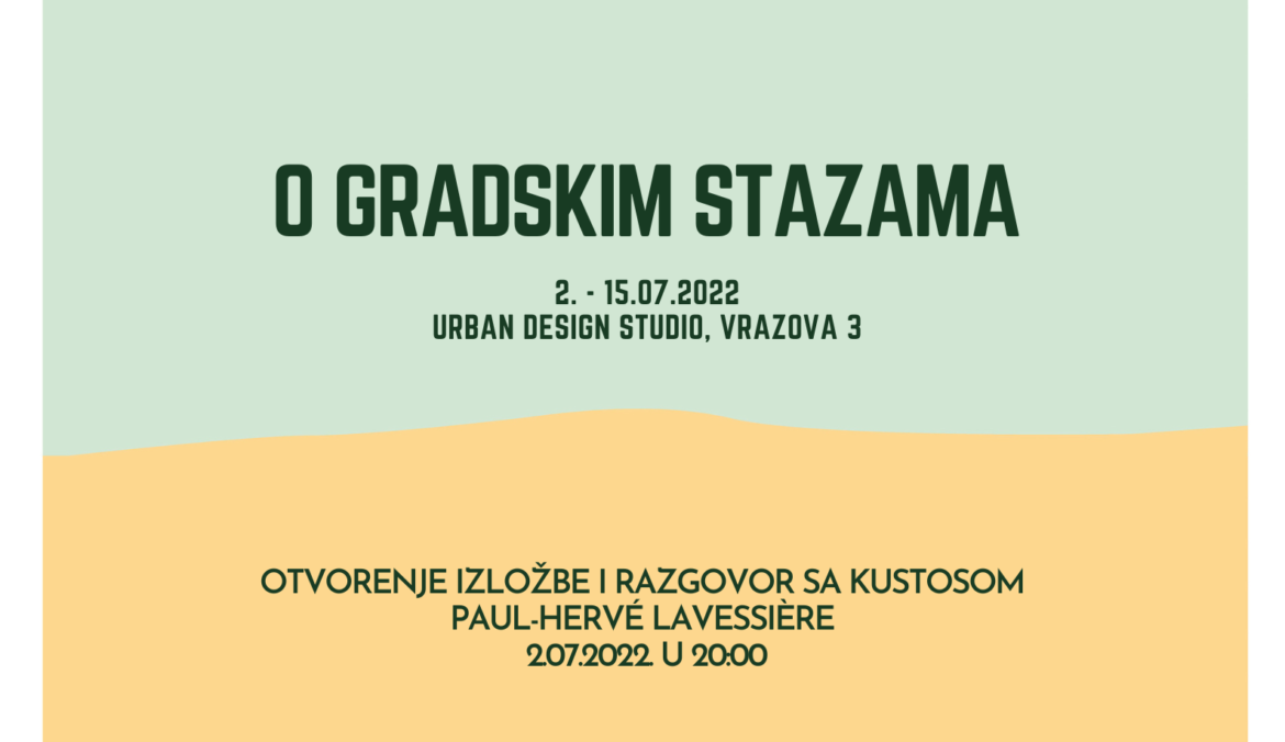
A table with a view is a glad to be part of this very exciting venue in Sarajevo. The exhibit Les Sentiers Métropolitains produced by the Pavillon de l’Arsenal and curated by Paul-Hervé Lavessière and Baptiste Lanaspeze of the Metropolitan Trails Agency.

The inauguration on the 2.7.2022 at 20h in the Urban Design Studio Sarajevo (Vrazova, 3) will start with a talk by Paul-Hervé Lavessière relating to walking as a praxis, the mapping of trails, and the projects that emerge.

This exhibit highlights the importance of the walking practice as a tool for knowledge and planning in every city. In Sarajevo, Crvena, The Association for Culture and Art has been leading walks since 2010, and is a reference in the design of walks and the production of related narratives. Finally, this practice is beginning to gain recognition among scholars, professionals, public and private institutions. There is a potential that the results of such activities can expand to achieve projects necessary to understand cities from another perspective, that of the walker, the visitor, the wanderer, the inhabitant and user, beyond the center and at the edges of the city, where new challenges are at play.

https://crvena.ba/izlozba-o-gradskim-stazamasarajevo2-15-07-2022/


Dunkerque des Îles, Ellis Island & Conrad

On the 13th of January 2022, I received an invitation from my friend, the artist-pedagogue Jean-François Pirson, to intervene in one of his projects. The invitation’s postcard was accompanied by two maps of the Dunkirk region, in risograph printing. The topography of the site is peculiar; the dunes seem to float like islands between the interlacing waterways. The landscape already incites for the sedimentation of different stories, of traces that will get washed away by the tide or windblown, now and then.

JF’s project stemmed from walking in this part of Dunkirk, from some findings on the ground and the story of migrants connected to the place, especially the nearby migrant camp of la Grande-Synthe.

I looked at the map and asked JF for guidance, how do you want me to intervene? I have never been there; I cannot have a real feel of this landscape. You are free to do want you want he said.

I look at the map; it is appealing. The waterways are streaks of blue, smearing the paper and concentrating in a big stain up north, the Channel. The dunes look like blown up bubbles trapped within the square framed map. Two red spots, number I and 3, refer to the legend of places. It is beautiful, but I am clueless.

First intervention

Then it happened. I was listening one day to a podcast related to the work of the french writer George Pérec. The movie Ellis Island, done by Robert Bober and commented by George Pérec was brought up. Somehow, the two territories aligned before me, on opposite sides of the globe, but a parallel story. One on the Channel, the other on the Hudson.

So the first intervention on JF’s map retraces the “opposite” parallels (I call them) between the story of Ellis Island and Dunkirk. The crisscrossing of key historic dates made the connection. Actually, this year 2022, in the midst of migration crises of different kinds, we are reminded of the opening of Ellis island, 30 years ago in 1892. The island on the Hudson, next to the Statue of the Liberty, became the salvation of migrants looking for bluer horizons on the other side of the Atlantic. Whereas the building of the Center for Migration in Ellis Island received the golden medal at the Paris Exposition Universelle in 1900, in 2016 the authorities are dismantling the fortune camps in Calais, and in 2017 the one of Linière in Dunkirk after a fire ravaged it. Dunkirk is a temporary island, like Ellis, where migrants await before joining the desired new land at the horizon. Some don’t wait, they dive in the blue waters with a precarious boat. The imminent Brexit made this channel crossing even more vital for the migrants, who are submitted to European migratory laws that suddenly won’t apply. 2018 witnessed an intensive traffic of small boats in the Channel; the 17th of April 1907 became historic with the arrival of 11,747 migrants in one day to Ellis. The tragic end of the story occurs when the illicit camp of la Grande Synthe in Dunkirk is evacuated on the 16th of November 2021; the migrants are left with nothing but their unbearable life. On the 24 of November 2021, a shipwreck in the Channel: 27 deaths, 2  survivors and one missing. Most of them didn’t know where to go after the camp’s destruction and were desperate to join family members in England.

Second intervention

Then I thought. The channel couldn’t be blue. It is not bluer on the other side. But deep red.

Red, like these veins on the landscape, not the blue streaks of the waterways, but the drained blood veins of the migrants drenching the sea.

In this story we all have blood on our hands. Joseph Conrad resurfaces, from further up north, on the south bank of the river Thames, near Gravesend. It is outside JF’s map, but the waters merge at the end, like the stories.  Heart of Darkness deserves a re-reading in the light of contemporary stories. As a reminder, I would paint the channel red, and entitle the second intervention: au coeur de la Manche, in the heart of the Channel. A tribute to 27 persons lying deep down on the seabed, the one that cannot be dismantled, and so much others.

Different persons answered the invitation of JF. All the maps were exposed at the Center La Plateforme in Dunkirk. They can be purchased and profits go to the migrant’s organization SALAM. If you happen to be around Dunkirk I would recommend the visit of JF’s expo entitled à travers champs. https://www.laplateforme-dunkerque.com/ for a different reading of Dunkirk.

Different interventions on JF’s basemap of Dunkerque.

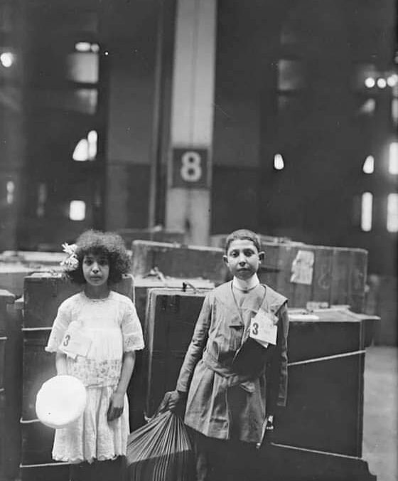
Photography in B&W: 1905. Brother & sister in Ellis Island awaiting transportation to Manhattan. courtesy of rarehistoricalphotos.com

Reading “A Game for Swallows”

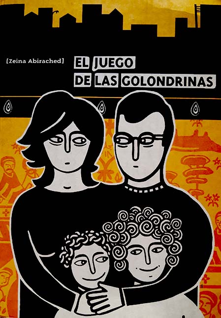
I was so happy to receive, in Sarajevo, my compatriot Zeina Abirached book: Mourir, partir, revenir: Le jeu des hirondelles. I received it in the Spanish version under the title El juego de las golondrinas. We are a Spanish-Lebanese couple and sometimes “castellano” seeps into my mainly francophone reading world; and it is fine, as I found the translation very well done.

It is suggestive to read Le jeu des hirondelles, A game for swallows in Sarajevo where I am now living; another city, like Beirut, that underwent war from 1992 until 1995. Sarajevo was under siege, the city surrounded, whereas Beirut was divided in two, the Eastern and Western part. The two cities have in common the “demarcation line”: a limit defined by the fighting parties and traced spatially to delimitate opposing territories. In Beirut it was called the green line, splitting the city in half. In Sarajevo it was more sinuous, running across neighbourhoods and around the surrounding hillsides. This spatial divider within the city becomes an extremely dangerous line to cross; the minimal infraction can be deadly. In each city, inhabitants found diversions to overcome this standoff for different reasons; these détournements became the subject of many stories.

Zeina’s graphic novel starts with a mapping of the green line in Beirut to understand the location of the distinct characters and grasp the tension that underlies the story of a day in her childhood during the war of 1984. Zeina and her brother are on one side of the green line whereas their parents are visiting the grandmother on the other side. The shelling worsens throughout the day, complicating the return home of the parents and making the awaiting longer than expected for the kids. But the two children are not alone. They spend the day with the rest of the inhabitants of the building that are accustomed to take refuge in the apartment of Zeina’s parents, mainly in its entrance, considered the safest room in the building. An array of stories relating to each neighbour are recounted while waiting for the parents to come back, against a backdrop of shelling and the description of everyday life’s features in wartime. The last pages of the book close in on the beginning of another war, this time displacing totally Zeina’s family from the building.

“Le jeu des Hirondelles” shows the surreal aspect endemic to wartime: while the city is divided, rival armies are fighting, the inhabitants, the neighbours in a building strive for a sense of normality within the horror; otherwise, everyone would go mad. This is seen especially in the character of Ernest, who continues to dress up to come down to the entrance room, like the rest of the neighbours, when the situation becomes critically unsafe; or the old lady Anhala who involves the kids in the making of “sfouf” a traditional homemade cake. The sense of community created in the building helped everyone survive their personal loss and grief. After depicting the state of the city at macroscale, the novel withdraws to the cramped space of the entrance room of an apartment on the first floor of a building on the frontline of the green line where a tapestry depicting the flight of Moises and the Hebrews from Egypt hangs ironically on the wall. This safe micro-oasis escapes the uncanny situation that war inflicts on cities and inhabitants.

Many similitudes with my readings on Sarajevo during wartime emerge; from everyday essential features like the search for water, the need for gas oil and fuel, the importance of fresh food and the dangerous outings, but also the fear, grief and the absence of answers to the question: Why is this all happening?

As a child, this lived experience is unforgettable; its shadow looms over the rest of the existence. Many children changed houses during the war in Lebanon, or flew with their parents to other countries, like the swallows, in a constant state of “refugee”, then coming back and flying again. Zeina has made a beautiful record of this childhood memory that many children in Lebanon, and probably Sarajevo share.

Mourir partir revenir: Le jeu des hirondelles. Zeina Abirached. Editions Cambourakis, 2007.

El juego de las golondrinas. Zeina Abirached. Ediciones Sinsentido, 2008.

Goga & Elmir

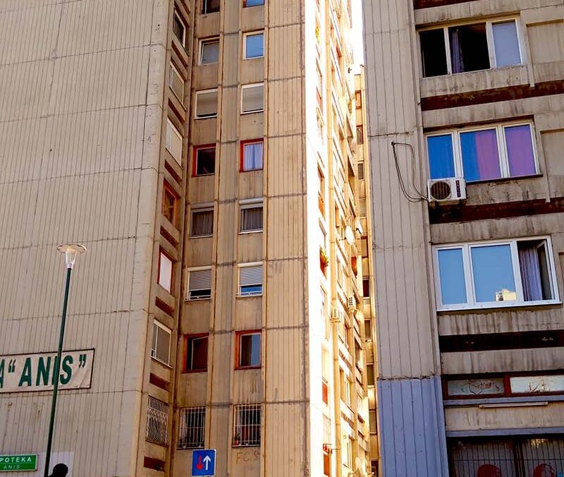
Last Monday I had a different walk in Sarajevo; this time it can be defined as “urban” in comparison with the previous walks on the surrounding hills, and “in company” instead of solitary. This walk was led by Goga and Elmir, a couple in love with the “other” Sarajevo, the one beyond the historic centre: Tito’s Sarajevo.

Whereas the historical centre is defined by the Ottoman Baščaršija and the Austro-Hungarian developments; the socialist period determined the extension of the city westward, into the Sarajevo Fields, lying beyond Marjin Dvor, where the Austro-Hungarian district ends. The first settlements were Grbavica and Čengić Vila. Soon the axis, linking the city to these new residential neighbourhoods, took form: Vojvoda Putnik street, today’s Zmaja od Bosne, densified with high rise buildings and several educational structures popping up on both sides while the tram ran along, connecting the eastern part of the city to its western one until Ilidža.

Neighbourhoods associated with socialist residential settlements have a different story. They differ from the Ottoman structure of Vakuf and Mahala, and the Austro-Hungarian city making along street alignments, defined by administrative buildings, residential blocks and squares. Socialist neighbourhoods respond to an urgent need for dense housing and community building. The growing working population in Yugoslavia and the ethics of socialist society gave shape to a new city form of dwelling. Housing should be equal to all, with no apparent distinctions of class or income. Therefore, it favoured apartment blocks where uniformity is easily achieved and the ground floor is freed to insert communal spaces such as green parks, squares etc. High-rise buildings with interstitial green public space or linked by a ground floor with an inner courtyard, are most common compositions for the settlements. These neighbourhoods function as almost independent entities in town, with all the residents’ needs and facilities being catered for within the settlement while disposing of a bus or tramway stop connecting to the rest of the city. They gained a very strong identity because of this autonomy and the inhabitant’s involvement in the neighbourhood’s life. From a residential settlement, they define a neighbourhood today. Probably Grbavica is the most representative.

These residential ensembles provide us with elements to think about city extensions; and the relation between spatial design and community engagement; which is the soul of a neighbourhood. Today, these parts of the city belong to its daily life rhythm and escape city branding. Usually, you won’t bump into tourists. There are no landmarks such as towers, museums or architectural relics or a “must visit” building figuring in the guide. But another kind of landmark, one that is especially evocative for the inhabitants of the neighbourhood and even becoming significant to Sarajevans. Like the Stadium in Grbavica, completed in 1953: Workers and employees from the railway workshop of Sarajevo were involved in the facility´s construction, that became the home stadium of the Željezničar, “the soccer club that traced its origins to a worker’s club in the interwar years” (Sarajevo, a Biography, Robert J.Donia). These facilities or “iconic” places in a neighbourhood have an intimate history linked to local micro-stories, you have to glean the records from a café’s owner, an old woman strolling, a taxi driver, or of course from Elmir and Goga. Sometimes buildings speak for themselves; their walls bear scars and traces of memories. You can clearly see that Grbavica was on the frontline during the civil war. Also, it is possible to guess the change in use of some features in the buildings, apparent in the facades, like for example the glass framing of much of the balconies. Is it for the need of more space indoors than outdoors? “An apartment without balcony was unthinkable” said Elmir; residents always wanted one. What happened? A change due to home appliances limiting the need to hang the washing, or the need for anonymity and avoiding eye contact with the neighbours? The downfall of community life?

We started at Alipašino Polje. Elmir explained briefly the process behind the construction of this housing complex: land and design are chosen by the administration, the construction is done by voluntary builders, the “work brigades”, that provided the workforce to build housing and infrastructure in the city. A steel structure serving as a crane is still existent near the tram tracks, and it was the one helping transport material from the factory to the building site. The apartments are appointed to the workers according to the points rewarding their work, workers become owners of their house. Public space is a paramount feature of the design; it connects the independently standing blocks and achieves a unity of the whole residential area. This “outside” is the natural extension for the housing. Elmir recounts inhabitants knew each other, children played together in the streets and parks; the famous “eyes on the street” concept of Jane Jacobs comes to my mind. I imagine an ambiance similar to Greenwich village’s Christopher street or even a secondary street in Barcelona, where residents of all age are sharing the sidewalk, some have taken out chairs and a coffee table, another is cutting the hair of a client outside because it is too hot in the shop, others are trying to sell the few watermelons left at the end of the day, or reprimanding a kid for throwing the ball onto the plants… “Eyes on the street” is a description attributed to a lively street, with housing, commerce and exchange between neighbours as the key to a safe environment and a sense of belonging.

Buildings from the socialist period are architecturally bold. They encompass a variety of architectural styles; from brutalist to international, to organic style. Indeed “Although the high-rise housing complex became the hallmark of socialism throughout Eastern Europe and the Soviet Union”, the Sarajevan version was tinged with a local variation attributed to architects that wished to abandon the official style of social realism and embrace modern architecture: “In 1950: the Association of Yugoslav Architects meeting in Dubrovnik, unanimously voted to abandon socialist realism as a guiding philosophy for their work. Thereafter, architects had unimpeded access to contemporary Western Architectural concepts and most buildings were constructed in the spirit of modern architecture prevailing at the time” (Both citations from Sarajevo, a Biography, Robert J. Donia).

From Alipašino Polje we continued to Grbavica. On our way, we made a coffee break at the famous café: La Palma, in Hrasno the neighbourhood located between Grbavica and Alipašino Polje. La Palma is renowned for being the first private sweetshop in Sarajevo. It opened in 1970; owner Ljumić Šaban is a pastry chef that previously worked in the emblematic café Oloman, before leading his own successful café. La Palma introduced western pastry to Sarajevo. Ivo Boras, the designer architect? Probably sought to design an elegant sweetshop, adapting modern details of the 70s to fin de siècle café atmosphere. Metallic kiosks encasing palm trees and a central fountain give the terrace an exotic touch. The interior is very luminous, with large windows framing the longitudinal facade. La Palma occupies the ground floor of a residential building on Porodice Ribara street. Whereas Oloman’s typical striped canopy has long disappeared on 23  Mašala Tita street, giving place to ManOlo Café. The play on the words didn’t save Oloman’s ambiance. It was one of the gravitational city spots in town like the eternal flame or the retail stores Robna Kuća, also known as Sarjaka.

After having our coffee, we crossed through Grbavica, a complex neighbourhood that deserves a whole post and an exclusive walk that is on my list, before extending the narrative. Our last stop was at Skenderija Sports and Cultural Center. This imposing building closes the perspective of the long Alipašina-Hamze Hume avenue rushing downhill from Koševo, and frames nicely the crowded hilltop of Sukbonar. This complex was achieved in 1969. Belgrade’s newspaper Borba, awarded the architects Živorad Janković, Halid Muhasilović and Ognjen Malkin its annual prize for the best architectural achievement in Yugoslavia. The opening of Skenderija was a happening on its own, with international guests such as Orson Welles, Yul Brynner and Sophia Loren for the première of the film Battle on the Neretva of Veljko Bulajic; also realized in the same year. Then in 1974, studio DOM led by Živorad Janković, Halid Muhasilović and Srecko Espak won the competition for the design of another Sports Centre, this time in Pristina: ‘Boro & Ramiz’ Sport and Recreation Center. The design bears an unmistakable resemblance to the Skenderija Sports complex; with the two wings of the building expanding on both sides of a central hall. Skenderija today is reminiscence of old glory, a part from hosting the ice skating and ice hockey competition during the Winter Olympics in Sarajevo in 1984; it has fallen into disuse. It houses the Ars Evi, a collection of Contemporary Art in Sarajevo, while awaiting the Modern Art Museum, designed by Renzo Piano and offered to the city in the war’s aftermath. In 1992 during the civil war, the Youth House was set on fire, only to be reconstructed fifteen years later; again in 2012, the roof of the ice hall collapsed; leaving it bare. Also, the large arena in Boro & Ramiz suffered a fire in 2000 and is still in disuse, while the smaller arena is still functioning. Živorad Jankovic was an important architect and academician in Yugoslavia. He became the dean of the University of Architecture of Sarajevo in 1981, then the city planning director of the city from 1970 to 1972.

From Skenderija, we took the Obala Maka Dizdara street running along the Miljacka river. On the opposite side, the picturesque alignment of Austro-Hungarian buildings unfolds following the river’s smooth line. We came across Gospođicina House, an elegant XIXth century bourgeois house with sgraffito painted murals on the facade. Elmir stopped to tell us the story behind this façade: Once the house of a rich jewish merchant, at the start of the WWII, the family was deported to the concentration camp of Jasenovac. The house became a detention centre led by the anti-Semitic Ustaše. Prisoners, jews and non-Croats, were held captive in the house’s basement. When the war was coming to an end, and just one day before the Ustaše abandoned the house, all prisoners were taken out to be hanged along the river.

Sarajevo holds many stories; that wash over the quiet river and stay trapped in time. Our stroll was coming to an end. The last stop was at the music pavilion adorning the Mejdan park. Elmir and Goga joined some members of the group for a lunch and a marvellous vista at the city from a traditional restaurant on the upper part of Bistrik. A remarkable journey. I am looking forward to more explorations with Elmir and Goga.

Elmir and Goga also run a holiday Lodge in Konjic, for explorations outside Sarajevo: www. herzegovinalodges.com.

Landscape vs Nature

“We go out into the open area since it is too cold in the shade. I devour the landscape. Life has conditioned me for such a gaze; I cannot do anything about it. Even the washing on the edge of the stream evokes for me the commemoration of the birth of the landscape. However, can we doubt that these people, in their own way, had and still have a profound sense of the landscape?”  (Thinking through landscape, Augustin Berque, 2013)

This is the second part of my first spring walk in Sarajevo, following a path leading to Sedrenik and Barice, and if you continue up further to Čavaljak. These are locations that are predilection outings for city dwellers in the weekend. This time I was back up on the main road of the Sedrenik village, from where I took Sedrenik Mali, a street getting narrower with each footstep, to finally transforming into a steep stony path, weaving in and out of dense woods and clear plains alternatively. Looking at the surroundings, I could discern the Ravne Bakije’s cemetery I came across on my first walk. After standing on a flat vantage point, I found myself amid high poplars and pine trees again. A soft light filtered, and birds were chirping. I was alone, and I felt this uncanny sensation woods deliver, of safety but also estrangement. Soon I reached a fenced enclosure bordering the park called Šuma Priljateljstva. It was closed; some kiosks at the beginning and folded sunshades near an ice cream spot testified of a public usually coming with kids to enjoy the facilities of the “natural” park.

Leaving the park behind, I continued along a road cutting through plains extending on each side. Few houses are scattered among these wide stretches of verdant grass. The panorama: thick strips of trees, a superposition of hilltops, and ultimately the mountains closing the perspective… a stratification of the “factual” environment, as Berque would call it.

Landscape is not the environment. The environment is the factual aspect of a milieu: that is, of the relationship that links a society with space and with nature. Landscape is the sensible aspect of that relationship. It thus relies on a collective form of subjectivity.” (Beyond the modern landscape, Augustin Berque, AA Files, No. 25, Summer 1993, pp. 33-37).

I am curious to know how this sensibility is expressed in Bosnia, this particular response to the environment. What is their understanding of landscape? This environment is very complex: land politics have successively shifted regime. The vakuf system that determined all land property aspects and shaped the territory during the four centuries of Ottoman rule was successively reformed under Austro-Hungarian, Kingdom of Serbs, Croats and Slavs, kingdom of Yugoslavia and Tito’s Yugoslavia. How did all these changes affect public and cultivated land, as well as urban institutions translate into the perception of the territory?

While meddling with these thoughts, I reached a panel entitled Barice od broja 23 do 33, indicating the postal number of the few houses at the beginning of the footpath, going down through the valley to reach Donje Biosko. I followed the rocky tracing. The prairies, the neatly divided cultivation and grazing plots, the flock of goats and the smell of manure; gave way to small houses on both sides of the bumpy path, henhouses, beehives, greenhouses, beautifully aligned furrows, suspicious dogs… It was curious for me to find this ambiance at one hour and a half from Sarajevo’s bustling urban centre.

Then, and probably triggered by some fruit trees on my way, I remembered when Lopakhin wants to cut down the cherry orchard in Chekhov’s play.

Lopakhin: […] But, of course, the place will have to be pulled down, as well as this house which is no good to anybody. The old cherry orchard should be cut down, too.

Liubov Andryeevna: Cut down? My dear man, forgive me, you don’t seem to understand. If there’s one thing interesting, one thing really outstanding in the whole county, it’s our cherry orchard.

Lopakhin: The only outstanding thing about this orchard is that it’s very large. It only produces a crop every other year, and then there’s nobody to buy it.

Gayev: This orchard is actually mentioned in the Encyclopaedia.

Lopakhin [glancing at his watch]: If you can’t think clearly about it, or come to a decision, the cherry orchard and the whole estate as well will be sold by auction. You must decide! There is no other way out, I assure you. There’s no other way.

Feers: In the old days, forty or fifty years ago, the cherries were dried, preserved, marinated, made into jam, and sometimes…

Gayev: Be quiet, Feers.

Feers: And sometimes, whole cartloads of dried cherries were sent to Moscow and Kharkov. The money they fetched! And the dried cherries in those days were soft, juicy, sweet, tasty….They knew how to do it then…they had a recipe…

Liubov Andryeevna: And where is that recipe now?

Feers: Forgotten. No one can remember it.

Thank god, nobody is thinking of selling off the orchards of Sarajevo’s surroundings for “building villas, these calculations about summer residents […]” yet. (The cherry Orchard, Anton Chekhov, 1903)

While walking, I think of this relation between nature, and the artifice of cultivating and processing products that becomes in a way who we are. Cherry jam, the nature is mediated. Then the paradise is lost: like the recipe… The environment constitutes more than means of production and transforms in a raison d’être in the world, a culture: “it is the only thing that matters in the whole wide world” and “The orchard figures in the encyclopaedia”. The birth of a landscape? At least Liubov Andryeevna has developed what Berque’s describes as essential to a landscape’s birth “the sensible aspect of that relationship” to the environment: “Oh my darling, my precious, my beautiful orchard! My life, my youth, my happiness…good-bye!…good-bye!”

My interpretation of course; my questioning about landscape versus environment, in the light of the sceneries deploying in front of me.

I reach Hladivode, I was looking forward to see the structure of the Hladivode Rezervoar, but nothing in sight. Probably is it behind a wall fenced area I spotted on entering the village? Houses were popping on each side of the road, always adorned with colourful flowerpots. I even saw two garden dwarfs intentionally positioned to have the best vista at the surroundings, as to insist on the magical effect of the scenery. The public bus reaches Hladivode; his last stop, on one side of the steep narrow road, allows the minimal space for a u turn to go down the hill again towards the city. Its presence positions Hladivode in the very limit of the city. The quietness is only disturbed by the grinding of a bike dragged uphill by a shy child. A table with a chair under a big tree reminds of the simple pleasures of life.

I was reaching the end of my sketched journey. The ascent movement of the beginning was giving place to an agreeable slow descent. Down along Baruthana street, I see two persons leaning graciously over cultivation furrows inserted in between the houses. I don’t know why but it is a comforting image, probably for a city dweller, to see that we haven’t completely lost our relation to land. I reach Sarajevskih Ghazija, a road marking the limits of a hilltop and therefore providing amazing views. I am probably looking at the Obhodža village on the opposite hilltop. Down in the valley I see a pedestrian path sneaking in between the trees; where could it lead? I have to check it. In the distance, the swirls of the highway R447, tunnels and bridges are like gigantic worms perforating the mountains, to make way through the hilly topography. I reach Višegrad gate again, the point of departure of the walk.

Pejzaž is the Bosnian word to refer to landscape, probably inherited from paysage, paesaggio. A visit to the Zmelajsiki Museum is necessary to further enlighten me on the Bosnian sensible and subjective relation to the environment; while I prepare for the next walk.

The first spring walk

This has been a long winter. For man and nature. Here in Sarajevo the continuous snowing and the pandemic left the city in a hibernating state.

That is why, with the advent of spring, the first glimpse at a blue sky is encouraging enough to take a walk. The mountains surrounding Sarajevo shed their brownish rags and changed into a shiny verdant garment. From Vratnik, the neighbourhood where I live, set on a hill, they seem so close. They surround the city under a cobalt sky and echo Courbet’s “Beauty provided by nature is superior to all artists’ compositions” 1.

I decided to take a walk to the upper part of the neighbourhood to reach a range of trees I see from my house. They form a crown on top of the hillside my neighbourhood leans against, and seem to trace a road on the hilltop. At my arrival, locals indicated me a few close places they like to go to find themselves in “nature”: “Up there, it is great for making a picnic, you have only the nature”. Čavljak, is one of them for example. When the weather was more clement, I did a small itinerary for the walk, meddling with the different appealing places that were appearing over the map. Then on a sunny day, I went for the walk with my itinerary and curiosity as guides.

My neighbourhood, Vratnik, is one of the oldest in town. It was developed under Ottoman rule in the 16th century. Vratnik was included in the walled perimeter of the city that was constructed after a raid of the Habsburg Prince Eugene of Savoy in 1697, that left most of the city burnt down. Starting in 1729, under Ottoman rule, Sarajevo constructed fortifications to protect the city. They comprised around 300 meters of walls and 4 towers and included existing bastions like the Bjeli Tabija (white bastion) built around the 15th century. The White Bastion is a major lookout in Vratnik and the site of cannonball during the Ramdan fasting period, indicating the time for iftar.

Some fragments of the fortification gates remain: the Širokac, and Ploča gates on the lower part of the neighbourhood; the Višegrad gate on the upper part. The Višegrad gate and the fort are reminiscence from an old trade route: the imperial route that linked Sarajevo to Istanbul via Višegrad.

After greeting Suleiman (“Sule” to all the inhabitants of the neighbourhood) the stallholder of fruits and vegetables in front of my house, I crossed the neighbourhood’s mejdan, or central plaza. It is just a wide broadening of the main street, around which are grouped; the fire station, a supermarket, the Vratnik Klub U.G. Penzionera, a newspaper stand, a bakery, a pastry shop and café, and different grocery shops. There is also a modest shrine, at the end of the mejdan, where the sidewalk widens under tall trees, between a hairdresser and an abandoned café. A big rectangular opening, with a steel grid, frames the inside, allowing you to peek at a perfectly rectangular and peaceful space.

I took a small pedestrian street to have a different crossing of the mejdan than my usual one, and came by the Porčina Džamija. Mosques define many of the streets in Sarajevo. You will localize it from a distance because of the minaret, but in the vicinity you will walk the length of a perimeter wall, pierced by small windows at eye level and protected by a wire mesh that allows you a glimpse to the inside. Usually a green haven, with some tombstones scattered among the grass.

1. Keeping an eye open, Essays on art, Julian Barnes, 2015, p.66

After this small deviation along Porčina pedestrian alley, I landed again on Carina street, just in front of the school Hamdija Kreševljaković. First, the “Primary School of the people VII”, built in 1937, then in 1959, it was renamed after a WWII hero Džavid (Hamza) Haverić (1920-1941); a shoemaker from Vratnik forming part of the resistance group during the war, arrested and sentenced to death. In 1992, the school finally adopted its actual name after a prominent Bosnian historiographer, Hamdija Kreševljaković, also born in Vratnik. The school building occupies a long stretch of the Carina street up, adding some welcomed shade to the walk. Once I reached Višegrad gate at the end of the street, instead of taking  Ćebedžije donje street, marked on my map, I decided to go for Ćebedžije gornje. I was drawn to this narrow street crawling up the hill with a short pedestrian stretch linking upper Ćebedžije to lower Ćebedžije.

Along the walk, little vestige, here and there. A ceramic mushroom, plants along a stone stairway, a wide opening in fragments of the fortification walls where the absent doorgate and hinges leave big empty cavities on each side, a monument to a šehid (martyr) resembling a modern sculpture, some benches arranged in a shady spot, stones surrounding the trunk of a newly planted tree. This shady corner seems to be invested by the neighbours. Public space is important to communicate and dialog for Bosnians, a sunbeam; and chairs are out for a coffee or talk.

I soon found myself on the Zmjevac road, walking in between trees and bird’s chirping, from time to time a bus, youngsters messing around on a motorcycle… It is hard to believe that in a 20 minutes’ walk from the mejdan of Vratnik, you would find yourself in a totally different environment. I was actually walking along the “tree crown” I was looking at from my house. The trees are so dense I couldn’t see the city beyond them.

I reached the famous Vidikovac, the coffee place located on a natural lookout at the city. People were enjoying a coffee in the sun, kids playing in a small playground under heavy trees, while the city lied beneath, unruffled. You can understand why Sarajevans reach out for nature on the weekends. It is close and gives you a marvellous view of the city. These vantage points remind me of certain cities, like Lisboa for example. But I can’t remember being confronted with this scope of landscape that wraps around you, a never ending urban horizon reaching the farthest parts of town.

I was in Sedrenik, and on the main street of the village by the same name. The road cuts through the cemetery of Ravne Bakije. I should have probably made a small detour to visit Crvena Tabija (Red fortress), but wanted to keep the pace and reach some of the points on my map. Next time.

On the way; cultivated terraces border the street, a sway on a square of grass. I was walking in a kind of torpor, lightness. The tranquillity in which a village is immersed around midday; when everybody is busy with a saw, playing outside, or at the orchard; reminded me of my childhood.

I continued the walk and reached the cemetery Grlića brdo. The impression is difficult to describe. It was monumental, not for its architecture, but for the spatial parameters. The low entrance gate and a lateral wall of white polished stone made the sky heavier on the visitor. I felt suspended between land and the immensity of a blue sky extending above and beyond me. On one side of the entrance gate, a small side door for pedestrian was open. The graves are staggered on both sides of the central pathway; following the natural gradient of the site. It is simple and beautiful. The graves consist of a low border delimitating the plot, some are covered with a ledger of white rock, or stone pebbles, or only planted with some flowers, and a headstone. Some flowers were looking very fresh. Ramadan was a few days before, and it is in the tradition to visit the cemetery on the following day, the šehid day.

I continued slowly. Some men were working on arranging the central path. I thought that the cemetery would have an exit at its end, but it didn’t. So I carefully walked the length of its bordering side to reach the starting point again; coming across some chickens from the neighbouring house, playfully strolling out in the sun, life and death, under the same blue sky.

When I came out I thought that after the cemeteries along La costa da morte in Galicia, Spain, Grlića brdo was one of the most beautiful cemeteries I have visited; for the natural setting. Located on a promontory; instead of looking at the Atlantic Ocean, it was overlooking Sarajevo. The feeling of loss of gravity in front of immensity was similar. While around the cemetery, ordinary life in the neighbourhood was taking place, inside of the peaceful houses punctuated by carefully kept orchards and vegetable plots.

I continued the walk, but after checking the time, I was already thinking of the spot where to stop the itinerary and head back to the point of departure. Moving forward along the main village road, Sedrenik, accompanied by the peaceful humming of horses from the Konjički Klub Hidalgo Sarajevo, I reached a crossroad marked by a public fountain. It was nicely constructed with stone benches surrounding it, an open air belvedere. I decided it was a good enough point to mark the descent back. I took Alije Nematka road down and couldn’t hold my joy; it was beautiful. At some point it becomes only pedestrian with stairs totally embracing the natural slope, and leading you softly down the hill with a breathtaking view of the surrounding. Reaching the end, there was a wide flat vacant spot, where a mother holding a small baby was looking at the cityscape. No wonder this view would could calm any distressed child.

I continued hurtling down the maze of steep streets that led me to my house again. I had the impression of coming from an outing rather than from a walk. I was thrilled with what I saw along the fragment of itinerary I preliminary composed, but also happy with the “off-track” discoveries. The last stretch of the walk was left undone. Next week, on a sunny day, I will continue.

This is the first narrative from a series of walk I will be undertaking in Sarajevo. Tracing a path to be walked together is the next step. Stay tuned!

It also starts with “S”

When I knew I will leave Skopje to live in Sarajevo for the next three years, I was happy and sad, and a little superstitious. Superstitious, because I first moved from my hometown Beirut to Barcelona, then from Madrid to Malabo and now from Skopje to Sarajevo, what will the next two cities be? following this alphabetical rhythmic, what will the next city’s starting letter be?

It also saddened me to leave the city of Skopje, that was becoming the companion of my everyday life, but happy to meet Sarajevo, and stay in the Balkans; that is being a very inspiring geographical context for my travelogues.

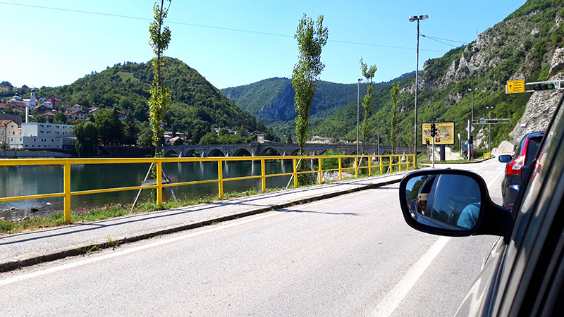
With the pandemic situation complicating traveling measures, we decided, my family and I, to do a road trip from Skopje to Sarajevo. The memory of this trip is a mix of a fleeting landscape, like colourful stains forming and dissolving on the car window, a break along the way for a quick car picnic in a highway station, and an unforgettable stay in the Mokra Gora village. This village is on the frontier of Serbia with Bosnia Herzegovina, and we spent the night in one of its local attractions, the old railway station. A motel was constructed near the railway, some train wagons were lying there, a reminiscence of another epoch. Today, in summer and winter, this train takes some 300 passengers on an eight shaped ride, along the mountain areas down the canyon of river Kamesina, in the valley of mountain Mokra Gora. To reach the motel in the Sargan Eight complex, we passed nearby the village called Kustendörf constructed by Emir Kusturica, for the movie Life is a miracle; this idyllic landscape is a perfect stage. In the surroundings of the motel, the houses are to be rented for vacation holidays. You had the impression of living in a village and in august it was full. Inflatable swimming pools were scattered in the small gardens in between the houses, children running in bathing suits among chickens and mothers calling to have dinner. The lightness of summer was all over the place, with the Mokra Gora mountains in the backstage softened by the tender light of the ending day. The next day, after leaving our mountain refuge, we entered Bosnia Herzegovina, crossing the town of Višegrad. When we first the bridge on the Drina, conceived by the great Turkish architect Sinan in 1577, time paused for some seconds. It was an epic moment when you are encountering a piece of narrative fiction under the actual sunlight and above shimmering water running under its arcades. It doesn’t happen often. We continued, and the landscape was a succession of green fields, folding and unfolding with slow meandering movements over a hilly topography. I remember a lot of tunnels crossing, because of the mountainous geography of the country, we were finally entering Sarajevo. At last, we were in front of our house in Vratnik, one of the oldest neighbourhoods in Sarajevo. This was the end of our road trip. We looked at the surroundings from our house balcony; we were on a hill of crowded houses, perching on top of each other’s and punctuated by some minarets here and there. On the near horizon line some tall buildings were peeking at us, the city centre sitting on the narrow strip of flat land, on both sides of the Miljacka river and surrounded by hilly neighbourhoods was welcoming us. We couldn’t wait to leave our luggage and take a walk.